Denmark |
Select by country / Denmark | ||
| Capital: | Copenhagen | 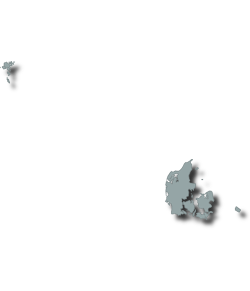 |
|
| Population: | 5.81 Million | ||
| GDP per capita: | € 54.8 Thousand | ||
| National Film Fund: | |||
| Regional Film Funds: | No | ||
| National Film Commission: | No | ||
| Incentive: | No | ||
| Located in Northern Europe, Denmark consists of the peninsula of Jutland and 443 named islands (1,419 islands above 100 square meters (1,100 sq ft) in total). Of these, 74 are inhabited (January 2015), with the largest being Zealand, the North Jutlandic Island, and Funen. The island of Bornholm is located east of the rest of the country, in the Baltic Sea. Many of the larger islands are connected by bridges; the Øresund Bridge connects Zealand with Sweden; the Great Belt Bridge connects Funen with Zealand, and the Little Belt Bridge connects Jutland with Funen. Ferries or small aircraft connect to the smaller islands. The four cities with populations over 100,000 are the capital Copenhagen on Zealand; Aarhus and Aalborg in Jutland; and Odense on Funen.
The country occupies a total area of 42,943.9 square kilometers (16,581 sq mi). The area of inland water is 700 km2 (270 sq mi), variously stated as from 500 to 700 km2 (193–270 sq mi).[citation needed] Lake Arresø northwest of Copenhagen is the largest lake. The size of the land area cannot be stated exactly since the ocean constantly erodes and adds material to the coastline, and because of human land reclamation projects (to counter erosion). Post-glacial rebound raises the land by a bit less than 1 cm (0.4 in) per year in the north and east, extending the coast. A circle enclosing the same area as Denmark would be 234 kilometers (145 miles) in diameter with a circumference of 736 km (457 mi) (land area only:232.33 km (144.36 mi) and 730 km (454 mi) respectively). It shares a border of 68 kilometers (42 mi) with Germany to the south and is otherwise surrounded by 8,750 km (5,437 mi) of tidal shoreline (including small bays and inlets). No location in Denmark is farther from the coast than 52 km (32 mi). On the southwest coast of Jutland, the tide is between 1 and 2 m (3.28 and 6.56 ft), and the tideline moves outward and inward on a 10 km (6.2 mi) stretch.[57] Denmark's territorial waters total 105,000 square kilometers (40,541 square miles).
Denmark's northernmost point is Skagen point (the north beach of the Skaw) at 57° 45' 7" northern latitude; the southernmost is Gedser point (the southern tip of Falster) at 54° 33' 35" northern latitude; the westernmost point is Blåvandshuk at 8° 4' 22" eastern longitude, and the easternmost point is Østerskær at 15° 11' 55" eastern longitude. This is in the small Ertholmene archipelago 18 kilometers (11 mi) northeast of Bornholm. The distance from east to west is 452 kilometers (281 mi), from north to south 368 kilometers (229 mi).
The country is flat with little elevation, having an average height above sea level of 31 meters (102 ft). The highest natural point is Møllehøj, at 170.86 meters (560.56 ft).[58] Although this is by far the lowest high point in the Nordic countries and also less than half of the highest point in Southern Sweden, Denmark's general elevation in its interior is generally at a safe level from rising sea levels. A sizeable portion of Denmark's terrain consists of rolling plains whilst the coastline is sandy, with large dunes in northern Jutland. Although once extensively forested, today Denmark largely consists of arable land. It is drained by a dozen or so rivers, and the most significant include the Gudenå, Odense, Skjern, Suså, and Vidå—a river that flows along its southern border with Germany.
The Kingdom of Denmark includes two overseas territories, both well to the west of Denmark: Greenland, the world's largest island, and the Faroe Islands in the North Atlantic Ocean. These territories are self-governing and form part of the Danish Realm. |
|||
 The Danish Film Institute
Select by country / Denmark
Denmark
Capital:
Copenhagen
Population:
5.81 Million
GDP per capita:
€ 54.8 Thousand
National Film Fund:
Regional Film Funds:
No
National Film Commission:
No
Incentive:
No
Located in Northern Europe, Denmark consists of the peninsula of Jutland and 443 named islands (1,419 islands above 100 square meters (1,100 sq ft) in total). Of these, 74 are inhabited (January 2015), with the largest being Zealand, the North Jutlandic Island, and Funen. The island of Bornholm is located east of the rest of the country, in the Baltic Sea. Many of the larger islands are connected by bridges; the Øresund Bridge connects Zealand with Sweden; the Great Belt Bridge connects Funen with Zealand, and the Little Belt Bridge connects Jutland with Funen. Ferries or small aircraft connect to the smaller islands. The four cities with populations over 100,000 are the capital Copenhagen on Zealand; Aarhus and Aalborg in Jutland; and Odense on Funen.
The country occupies a total area of 42,943.9 square kilometers (16,581 sq mi). The area of inland water is 700 km2 (270 sq mi), variously stated as from 500 to 700 km2 (193–270 sq mi).[citation needed] Lake Arresø northwest of Copenhagen is the largest lake. The size of the land area cannot be stated exactly since the ocean constantly erodes and adds material to the coastline, and because of human land reclamation projects (to counter erosion). Post-glacial rebound raises the land by a bit less than 1 cm (0.4 in) per year in the north and east, extending the coast. A circle enclosing the same area as Denmark would be 234 kilometers (145 miles) in diameter with a circumference of 736 km (457 mi) (land area only:232.33 km (144.36 mi) and 730 km (454 mi) respectively). It shares a border of 68 kilometers (42 mi) with Germany to the south and is otherwise surrounded by 8,750 km (5,437 mi) of tidal shoreline (including small bays and inlets). No location in Denmark is farther from the coast than 52 km (32 mi). On the southwest coast of Jutland, the tide is between 1 and 2 m (3.28 and 6.56 ft), and the tideline moves outward and inward on a 10 km (6.2 mi) stretch.[57] Denmark's territorial waters total 105,000 square kilometers (40,541 square miles).
Denmark's northernmost point is Skagen point (the north beach of the Skaw) at 57° 45' 7" northern latitude; the southernmost is Gedser point (the southern tip of Falster) at 54° 33' 35" northern latitude; the westernmost point is Blåvandshuk at 8° 4' 22" eastern longitude, and the easternmost point is Østerskær at 15° 11' 55" eastern longitude. This is in the small Ertholmene archipelago 18 kilometers (11 mi) northeast of Bornholm. The distance from east to west is 452 kilometers (281 mi), from north to south 368 kilometers (229 mi).
The country is flat with little elevation, having an average height above sea level of 31 meters (102 ft). The highest natural point is Møllehøj, at 170.86 meters (560.56 ft).[58] Although this is by far the lowest high point in the Nordic countries and also less than half of the highest point in Southern Sweden, Denmark's general elevation in its interior is generally at a safe level from rising sea levels. A sizeable portion of Denmark's terrain consists of rolling plains whilst the coastline is sandy, with large dunes in northern Jutland. Although once extensively forested, today Denmark largely consists of arable land. It is drained by a dozen or so rivers, and the most significant include the Gudenå, Odense, Skjern, Suså, and Vidå—a river that flows along its southern border with Germany.
The Kingdom of Denmark includes two overseas territories, both well to the west of Denmark: Greenland, the world's largest island, and the Faroe Islands in the North Atlantic Ocean. These territories are self-governing and form part of the Danish Realm.
Funds and incentives