Bosnia and Herzegovina |
Select by country / Bosnia and Herzegovina | ||
| Capital: | Sarajevo | 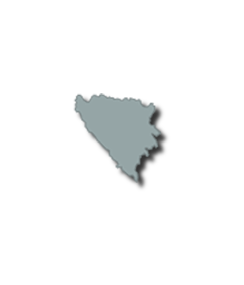 |
|
| Population: | 3.3 Million | ||
| GDP per capita: | € 14.7 Thousand | ||
| National Film Fund: | No | ||
| Regional Film Funds: | No | ||
| National Film Commission: | No | ||
| Incentive: | No | ||
| Bosnia and Herzegovina is in the western Balkans, bordering Croatia (932 km or 579 mi) to the north and west, Serbia (302 km or 188 mi) to the east, and Montenegro (225 km or 140 mi) to the southeast. It has a coastline about 20 kilometres (12 miles) long surrounding the town of Neum. It lies between latitudes 42° and 46° N, and longitudes 15° and 20° E. The country's name comes from the two alleged regions Bosnia and Herzegovina whose border was never defined. Historically, Bosnia's official name never included any of its many regions until the Austro-Hungarian occupation. Sutjeska National Park contains Maglić, which is the highest mountain in Bosnia and Herzegovina, as well as Perućica, which is one of the last remaining primeval forests in Europe. Una river, Una National Park. Drina river canyon, Višegrad. The country is mostly mountainous, encompassing the central Dinaric Alps. The northeastern parts reach into the Pannonian Basin, while in the south it borders the Adriatic. The Dinaric Alps generally run in a southeast–northwest direction, and get higher towards the south. The highest point of the country is the peak of Maglić at 2,386 metres (7,828.1 feet), on the Montenegrin border. Other major mountains include Kozara, Grmeč, Vlašić, Čvrsnica, Prenj, Romanija, Jahorina, Bjelašnica and Treskavica. The geological composition of the Dinaric chain of mountains in Bosnia consists primarily of limestone (including Mesozoic limestone), with deposits of iron, coal, zinc, manganese, bauxite, lead, and salt present in some areas, especially in central and northern Bosnia. Overall, nearly 50% of Bosnia and Herzegovina is forested. Most forest areas are in the centre, east and west parts of Bosnia. Herzegovina has a drier Mediterranean climate, with dominant karst topography. Northern Bosnia (Posavina) contains very fertile agricultural land along the Sava river and the corresponding area is heavily farmed. This farmland is a part of the Pannonian Plain stretching into neighboring Croatia and Serbia. The country has only 20 kilometres (12 miles) of coastline, around the town of Neum in the Herzegovina-Neretva Canton. Although the city is surrounded by Croatian peninsulas, by international law, Bosnia and Herzegovina has a right of passage to the outer sea. |
|||
Select by country / Bosnia and Herzegovina
Bosnia and Herzegovina
Capital:
Sarajevo
Population:
3.3 Million
GDP per capita:
€ 14.7 Thousand
National Film Fund:
No
Regional Film Funds:
No
National Film Commission:
No
Incentive:
No
Bosnia and Herzegovina is in the western Balkans, bordering Croatia (932 km or 579 mi) to the north and west, Serbia (302 km or 188 mi) to the east, and Montenegro (225 km or 140 mi) to the southeast. It has a coastline about 20 kilometres (12 miles) long surrounding the town of Neum. It lies between latitudes 42° and 46° N, and longitudes 15° and 20° E. The country's name comes from the two alleged regions Bosnia and Herzegovina whose border was never defined. Historically, Bosnia's official name never included any of its many regions until the Austro-Hungarian occupation. Sutjeska National Park contains Maglić, which is the highest mountain in Bosnia and Herzegovina, as well as Perućica, which is one of the last remaining primeval forests in Europe. Una river, Una National Park. Drina river canyon, Višegrad. The country is mostly mountainous, encompassing the central Dinaric Alps. The northeastern parts reach into the Pannonian Basin, while in the south it borders the Adriatic. The Dinaric Alps generally run in a southeast–northwest direction, and get higher towards the south. The highest point of the country is the peak of Maglić at 2,386 metres (7,828.1 feet), on the Montenegrin border. Other major mountains include Kozara, Grmeč, Vlašić, Čvrsnica, Prenj, Romanija, Jahorina, Bjelašnica and Treskavica. The geological composition of the Dinaric chain of mountains in Bosnia consists primarily of limestone (including Mesozoic limestone), with deposits of iron, coal, zinc, manganese, bauxite, lead, and salt present in some areas, especially in central and northern Bosnia. Overall, nearly 50% of Bosnia and Herzegovina is forested. Most forest areas are in the centre, east and west parts of Bosnia. Herzegovina has a drier Mediterranean climate, with dominant karst topography. Northern Bosnia (Posavina) contains very fertile agricultural land along the Sava river and the corresponding area is heavily farmed. This farmland is a part of the Pannonian Plain stretching into neighboring Croatia and Serbia. The country has only 20 kilometres (12 miles) of coastline, around the town of Neum in the Herzegovina-Neretva Canton. Although the city is surrounded by Croatian peninsulas, by international law, Bosnia and Herzegovina has a right of passage to the outer sea.
Funds and incentives